

Features Print Map
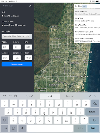
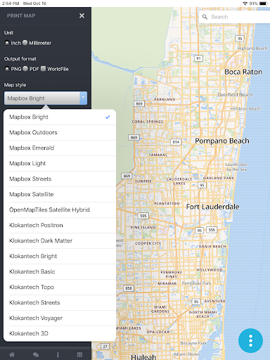
Print Map is used for preparing offline high quality georeferenced PNG maps and PDF from custom vector tile basemaps (OpenMapTiles and MapBox) with custom configurable stylesheets.Easily Export High Quality Maps from a mobile app Set initial view by searching or entering Lat LongChoose Output format (PNG or PDF)Select a Map Style based on either MapBox or OpenMapTiles Vector Tile Basemaps and Satellite ImagerySet your page size and DPIThe PNG Images can optionally include PGW -Worldfile and PRJ-Projection sidecar files that are recognizable by all GIS Mapping Software packages and many mobile apps.
The PNG images can also be inserted into reports and documents.
Lifestyle
Enhance your lifestyle with personalized tips and features.
Automotive
Manage and monitor your vehicle with smart features.
Offline Mode
Use the app without an internet connection. Your data syncs when you're back online.
See the Print Map in Action
Get the App Today
Available for Android 8.0 and above